
Austin Neighbors Block Record Sources
Public records can describe Austin parcels and community resources around an Austin address, but they answer different questions. Start with the Austin map layer to identify adjoining legal lots. Use the Austin appraisal account for property context, then keep Austin deeds, permits, code cases, and organization records in their own lanes. An Austin property owner is not automatically an occupant. An Austin community contact is not a member roll. The right approach to Austin records is to label each result by the record type that produced it.
| Source | What it shows about a block | Access |
|---|---|---|
| Austin City Property Profile | Austin parcel geometry, lot and block layers, subdivision, permits, zoning, historic, ZIP, census, and annexation layers | Austin public map viewer; it is not a deed, title, or occupancy opinion. |
| Austin TCAD property search | Austin appraisal account, owner, property or situs address, and possible tax mailing address | Austin public search; current-year work is in progress and the record does not prove where someone lives. |
| Travis County Clerk index for Austin | Austin deeds, plats, liens, legal descriptions, and recorded party roles | Online index is largely mid-1980s forward, with older books, microfilm, and archive paths. |
| Austin AB+C and Citizen Connect | Austin address-linked permit, folder, project, complaint, date, and status context | Public Austin city searches; a permit or complaint needs its own status reading. |
| Community Registry and Austin Neighborhood Council | Austin public organization contacts, meeting details, stated boundaries, and association routes | Registry data is self-reported; neither source is an Austin citywide resident directory. |
The Austin public voter lookup is deliberately absent as an Austin block-browsing source. It is an individual search that requires first name, last name, and birth date. Texas public voter categories, protected-address rules, and suppression procedures do not authorize an Austin household or block roster.
Map Austin Neighbors Parcel by Parcel
The Austin City Property Profile is the official starting point for an immediate Austin block. Locate the Austin subject address, then turn on the Austin TCAD parcel layer, Parcel IDs, Lot Lines, Lot and Block IDs, Recorded Subdivision, and Addresses. The map can also show Austin permits, zoning, historic, ZIP, census, and annexation layers. Those layers add local context, but they do not change the legal lot boundary. In Austin, preserve the feature's source-specific ID before trying to match it in TCAD or the recording index.
- Geocode or locate the Austin subject address and open its parcel popup. Save the Austin parcel, lot, block, subdivision, and address identifiers that are actually displayed.
- Pan one parcel width at a time around the Austin property or select each touching polygon. Check the opposite side, rear, and corner parcels instead of assuming every nearby parcel is adjacent.
- For each adjacent Austin parcel feature, record whether it shares a boundary, touches only at a corner, or is separated by an Austin street, alley, or easement. Then open the TCAD record for appraisal context.
- Use a party name, legal description, and instrument date in the Travis County Clerk index only when an Austin deed or plat question needs a separate answer.
- Keep the Austin query date and layer URL. Map controls and field availability can change, and parcel adjacency is not the same as occupancy.
For a longer Austin named-street record chain, use the Austin street directory. That workflow follows the Austin street and historical address trail, while this method stays with the immediate legal lots.
Austin Parcel Record Limits
An Austin parcel map is highly useful for geometry, but it cannot establish a full Austin household. Austin TCAD identifies an appraisal or tax record, not a statement of where a person sleeps or receives all mail. A grantor or grantee is an instrument role, not necessarily an occupant. Trusts, corporations, estates, attorneys-in-fact, and heirs can appear in recorded instruments tied to Austin parcels. An Austin address may also be a mailing, situs, legal, historical, business, or counsel address. Keep those labels intact when comparing Austin records.
Commercial neighbor-search categories may combine Austin public property, directory, and court data. Their apparent convenience does not remove matching, stale-address, or role-label problems. Official Austin sources make their record boundaries visible, even when their scope is narrower. Use the Austin official system when a parcel, permit, case, or organization question needs to be checked, and do not turn a name match into a claim about a current household.
| Official parcel and civic records | Identify a source, field, date, and record role. They are best for checking one documented question with the custodian's limits visible. |
|---|---|
| Commercial neighbor-search category | May combine several data types, but matching methods, source dates, and address roles can be unclear or stale. |
| Safe conclusion | Describe a parcel, recorded party, permit, complaint status, or organization entry only as that source supports it. |
Note: A property or tax entry does not establish current residence, a household roster, or neighborhood membership.
Austin AB+C Property Records
Austin Build + Connect provides public searching without registration for permits and related city development records. Search choices include permit number, Folder RSN, ROW ID, case number, property, project name, type, and date range. A permit number uses a year, six digits, and two letters. Detail tabs can include folder information, linked properties and addresses, associated people, fees, process notes, and attachments. A related permit can be in a separate folder, and an address can have more than one permit.
The AB+C public-search view is an official place to check address-specific municipal activity before making any claim about the block.
A permit result can document a folder or project record. It does not prove that work was completed or identify who occupies the property. If the needed historical file is not exposed, use Development Services records or the City Public Records Center rather than declaring that no record exists.
Austin Code Record Status
Citizen Connect code-complaint search accepts an address, case ID, or region. It supports map navigation, region and date filters, multiple regions or date ranges, and pin hover or click. The reviewed Open Data fields include Date, Status or Disposition, Case or Reference, Link, Complaint, and ID. Save the dataset or query date because snapshots are dated and field values can change.
The City code-complaint search places a complaint record in its correct municipal context for the block.
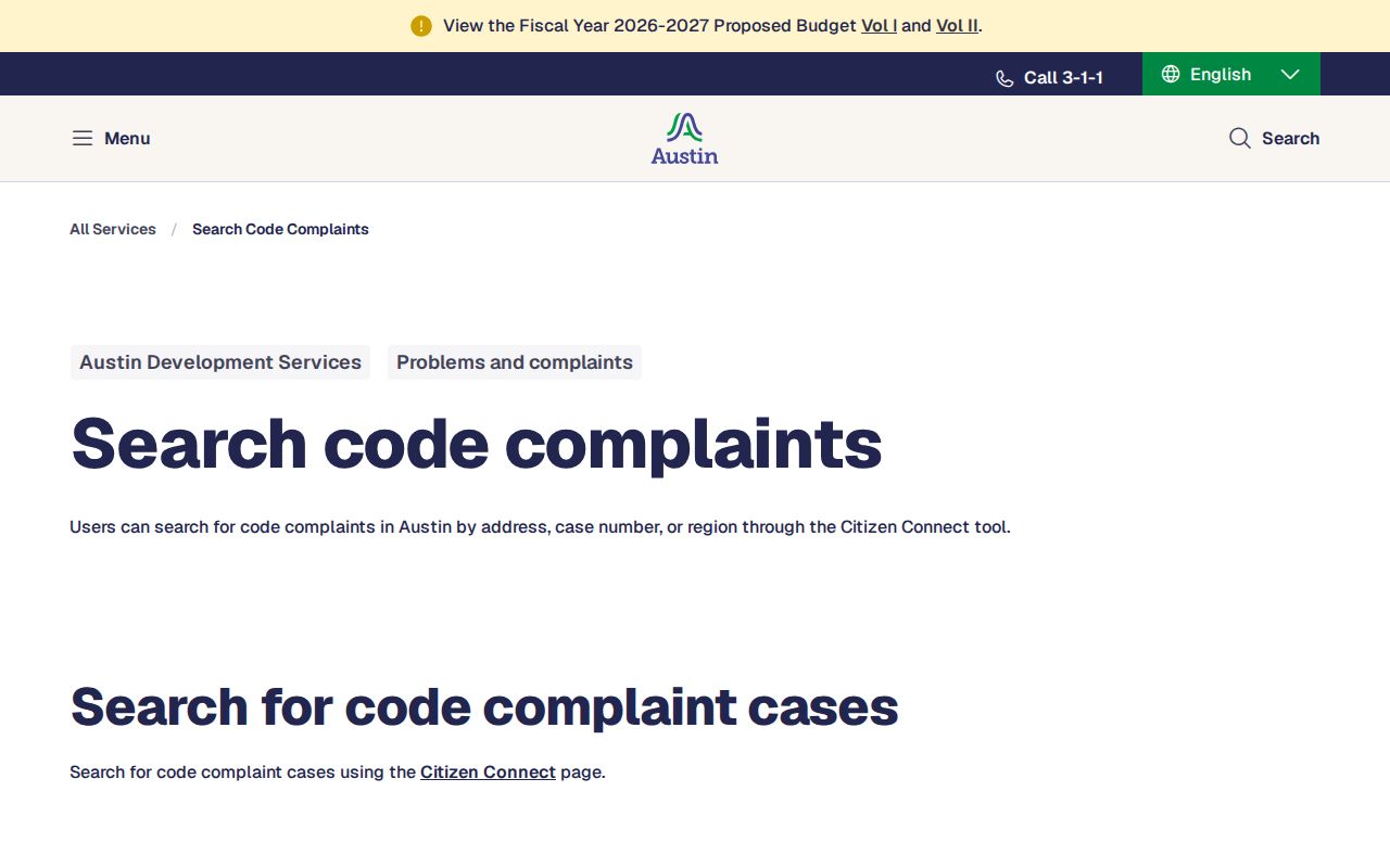
A complaint is an allegation or service record. Read the status or disposition directly and do not treat the existence of a map pin as a finding of a violation.
Austin Neighbors Community Contacts
The Austin Community Registry is a route to civic and area organizations, not a resident roll. It searches by organization name or five-digit mailing ZIP, and either field may be omitted. Registry rows can include an organization name, primary contact, membership count, meeting information, stated boundary, and updated date. The ZIP is based on the organization's mailing address and can be a post office box. Boundaries are registrant-drawn rather than standardized municipal lines.
| Organization source | Austin examples or coverage | Contact or directory boundary |
|---|---|---|
| Austin Community Registry | Self-registered groups including Allandale, Anderson Mill, and North Acres | Search by name or five-digit mailing ZIP; entries may list contact and meeting details, but no complete member roster. |
| Austin Neighborhood Council | More than 80 member associations, including Allandale, Barton Hills, Bouldin Creek, Brentwood, Cherrywood, Crestview, Dawson, and East Cesar Chavez | Umbrella member list; the contact or joining route is association-specific and not a citywide resident directory. |
| Adopted neighborhood plans | Bouldin Creek, Brentwood/Highland, Crestview/Wooten, Hyde Park, North Loop, Old West Austin, Rosewood, South Congress, and other plan areas | Planning documents supply adoption and boundary context, not membership or resident records. |
Congregation, block-watch, fraternal, and civic-club rosters were not found as open official Austin resident directories in the reviewed sources. The safe route is an organization's own public contact page or its City Registry entry, without collecting private members.
Austin Neighborhood Council Members
The Austin Neighborhood Council member list is useful for finding the association layer around an address after the parcel and city-limit questions are settled. Its member examples include Allandale, Barton Hills, Bouldin Creek, Brentwood, Bryker Woods, Cherrywood, Crestview, Dawson, East Cesar Chavez, Eastwoods, Galindo, Hancock, and Highland Park West Balcones. Membership in the council does not make an association boundary official or establish who lives inside it.
The Austin Neighborhood Council membership page shows the public association route that complements, but does not replace, parcel records.
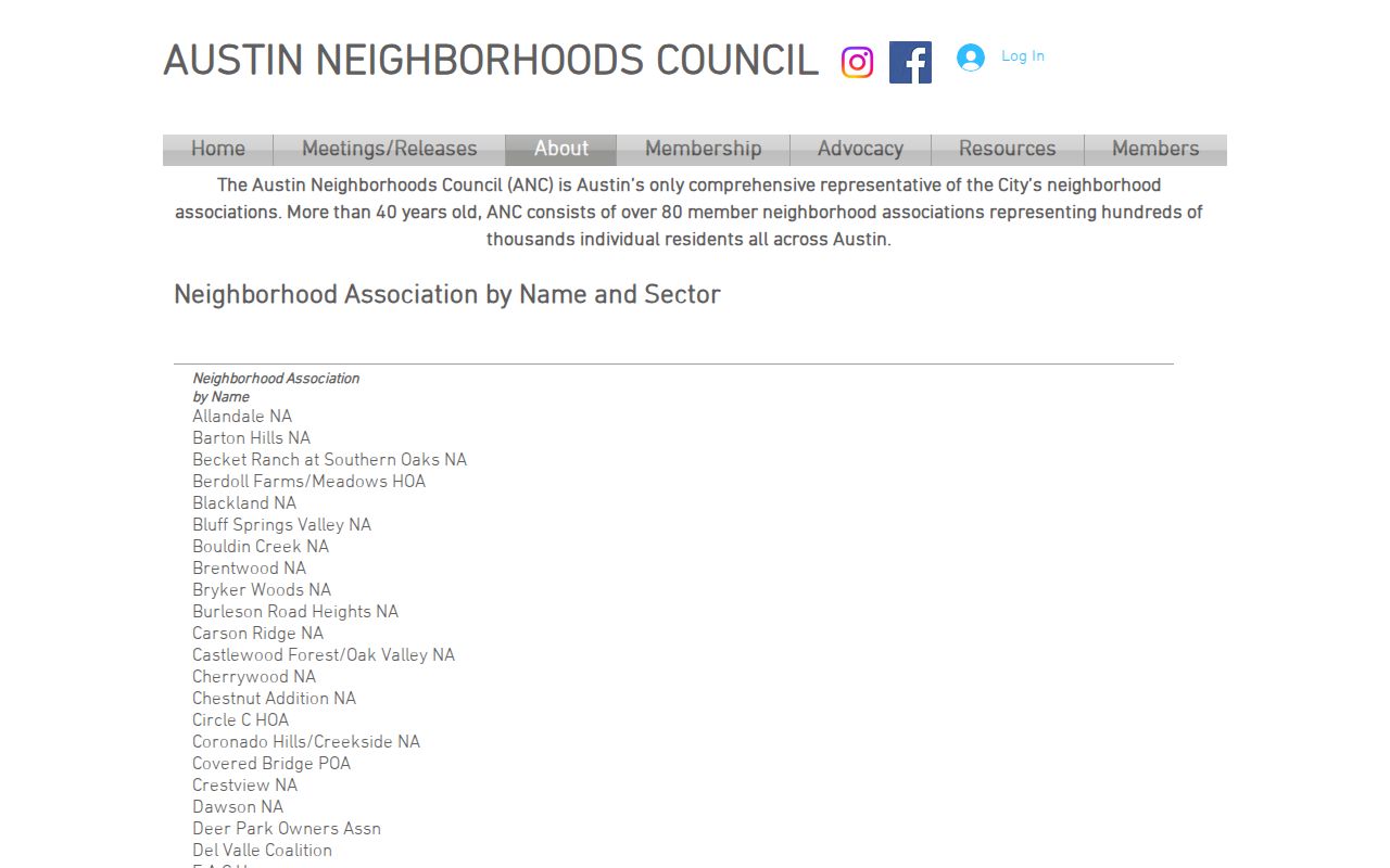
Use an association page to find a public contact or meeting route. Do not assume that an umbrella list is complete, current for every association, or a list of the people on the block.
Austin Voter Lookup Limits
The Travis County voter lookup requires an individual's first name, last name, and birth date. It is not a browseable block layer. Texas public voter categories do not create a lawful public household roster, and a full voter file is a separate Secretary of State request with its own statutory and privacy conditions. Do not run individual searches to assemble or display a list of people around an Austin address.
Texas Election Code guidance protects Social Security, driver-license or personal-identification information, protected addresses, and confidential-program data. Travis County also has a voter web-suppression form, and the state has protected-voter procedures. Treat a voter response as election-registration status as of the source date, not proof of a current physical location or a neighborhood connection.
Austin Boundary Record Layers
An Austin address can sit within several different boundaries at once. City limits, Travis County, a postal city label, a ZIP polygon, an adopted neighborhood plan, a historic district, and a Community Registry boundary are separate layers. A City ZIP field does not establish a USPS delivery point, and a registrant-described association boundary is not an official municipal neighborhood. Check the relevant map or custodian for the question at hand.
Historical addresses need an extra date check. Austin has annexation, disannexation, street renaming, address reassignment, redevelopment, and planning overlays. A record can be accurate for the boundary in force when it was created but not match a modern map label. Record the source's original address wording and date beside any current GIS crosswalk.
Austin Neighbors Privacy Limits
Household members, delivery-customer lists, and utility information are not dependable public parcel fields. The federal Driver's Privacy Protection Act restricts motor-vehicle personal information. Texas public-record law has exceptions and confidentiality statutes, while court records can contain sealed, juvenile, adoption, victim, or protected-party material. The Texas Address Confidentiality Program supplies a substitute mailing address and controlled disclosure for qualifying participants. Their actual addresses should never be sought or displayed.
Use the smallest amount of detail needed for a lawful personal purpose. A safe record note identifies the source, record type, date, jurisdiction, and official link, without publishing sensitive contact or location information. The Travis County public-information request route and City records channels are for existing records, subject to redaction and access rules. They are not a way to request a custom list of people around a block.
Lawful use. Use Austin neighbors records for personal, lawful research and community context. Do not use any record to watch, stalk, harass, threaten, intimidate, or expose a protected person.