
Austin ZIP Coverage at City Limits
Austin's official ZIP map is a city-limit coverage list. It identifies postal ZIPs wholly or partially inside Austin, including 787xx groups and surrounding 786xx areas that touch the boundary. That wording matters. A ZIP on the map is not necessarily city-only, and the research did not locate official neighborhood labels for every ZIP. Keep named neighborhood research separate from postal metadata. The Austin ZIP code directory therefore uses the full address, not a generalized neighborhood claim. For an address record, retain five fields: postal ZIP, postal city, state, city-limit status, and county status.
| Postal group on Austin City map | City-map status | Postal verification | Research caution |
|---|---|---|---|
| 78701-78705 | Listed as wholly or partly inside Austin limits | Confirm the individual delivery address with USPS | Map inclusion is not proof that every address is inside the city |
| 78712, 78717, 78719 | Listed on the Austin official coverage map | Use current Austin USPS data for postal-city confirmation | Do not assign a neighborhood from the ZIP alone |
| 78721-78727 and 78729-78739 | Listed on the Austin official coverage map | Check the Austin address rather than a group label | Postal, city, and county scopes can differ |
| 78741-78754 and 78756-78759 | Listed on the Austin official coverage map | Use USPS for delivery designation | An Austin GIS test is still needed for a city-limit claim |
| Boundary-touching 786xx areas | Included where the postal area touches Austin | Verify each Austin address and county | Do not call the entire postal area Austin |
The City of Austin ZIP-limit map is the reviewed official starting point for the Austin coverage list. The City explains that its map speaks to city limits, not to every delivery address using an Austin label.
Austin ZIP GIS Layer Fields
The City of Austin ZIP REST layer is the spatial tool for testing how a location relates to a postal polygon. It exposes ZIPCODE, CITY, STATE, and geometry fields. Each ZIP code field serves a mapping purpose, not a statement that a particular address has one legal jurisdiction. Use the polygon with the exact address and retain the Austin query or boundary result used. The CITY value should not be treated as a USPS delivery-point determination. For a current postal answer, the City address page directs users to USPS ZIP Lookup or 800-275-8777 because City of Austin Address Management does not maintain ZIPs.
| ZIPCODE | Postal polygon label used for the Austin GIS query. It is a mapping field, not a statement that every address shares one jurisdiction. |
|---|---|
| CITY | Austin city text stored with the layer. Confirm an address's accepted postal city through USPS. |
| STATE | State label in the Austin GIS layer, useful as a basic query check. |
| Geometry | The polygon used to test spatial relationship. Pair it with an Austin city-limit and county check when those questions matter. |
Austin's ZIP GIS REST layer is the official map service used for this boundary check.
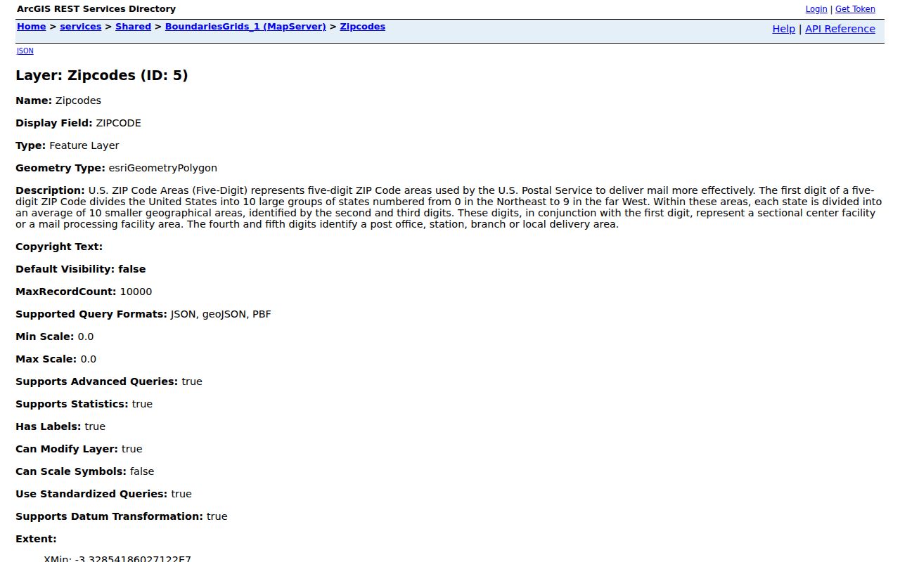
An Austin polygon establishes mapped geographic context. It does not convert a postal label into a current resident list, city service area, or neighborhood boundary.
Austin Postal Labels Versus City Limits
Austin and Travis County are different search scopes, and the word Austin can mean an incorporated city, a county seat, a postal city, a metro address, or a historical place name. The city-limit map and the GIS layer address Austin municipal geography. USPS controls postal-city combinations and publishes a monthly City State Product for current postal data. An Austin city-limit conclusion therefore needs a City boundary test, while a delivery conclusion needs USPS. County status adds another check because an Austin mailing ZIP can also reach outside Travis County.
- ZIP
- An Austin postal delivery area label. It is not a municipal boundary or a neighborhood name.
- ZIP+4
- An added delivery detail used within an Austin ZIP. It does not change the city-limit status of an address.
- Unique or special-use ZIP
- An Austin ZIP that may appear in official lists for a particular use or organization. Confirm its current service type with USPS.
- Carrier route
- An Austin postal delivery-routing concept, not a city political boundary or a resident roster.
The USPS City State Product is updated monthly and is the documented route for acceptable city and state combinations. Use the postal result as a postal result. Use the City of Austin map or an Austin GIS boundary test for the separate question of whether an address is inside Austin city limits.
Finding Austin Records by ZIP Code
Use a ZIP to narrow geography before moving to an address-specific record. This Austin ZIP code workflow starts with a parcel or street, not a claim that a postal area yields a resident list. The reviewed TCAD property-search landing page offers owner name, property address, account number, DBA, and map-search modes, but it does not expose a verified ZIP-wide search. Travis County voter lookup is an identity and status tool requiring first name, last name, and birth date, not a ZIP roster. Those limits are important: Austin research should not promise a list of everyone in a postal area.
- Check the full Austin address with USPS and preserve the returned postal city and ZIP.
- Test the location against the Austin City ZIP polygon, city-limit information, and county status when jurisdiction matters.
- Search Austin TCAD by the actual property address, account number, owner name, DBA, or map mode rather than claiming a ZIP filter exists.
- Use the Austin Property Profile map for parcel, permit, annexation, planning, and other mapped context.
- Move to an Austin street-level record chain only after the address is fixed and the relevant custodian is clear.
Once a postal area is narrowed to an address or named street, the Austin street directory provides the separate address-based workflow using TCAD, GIS, and recorded instruments.
An Austin TCAD result may display an account or parcel number, owner as shown, property or situs address, mailing address, legal description, values, exemptions, and characteristics when the live card exposes them. Current-year information is work in progress, and neither a situs nor mailing field proves who currently occupies the property.
Austin Community Registry ZIP Searches
The City of Austin Community Registry is a local organization tool, not a people directory. It does not add a household listing to an Austin ZIP code directory. Its search form accepts Organization Name and a five-digit ZIP; either can be supplied, and a blank search returns all registry entries. Rows can include organization name, primary contact, membership count, meeting information, boundary description, and updated date. The City describes the data as self-registered, non-confidential information updated annually or monthly through Open Data. Treat contact and meeting details as organization-provided and time-sensitive.
| Organization Name | Optional search field for a named registered organization. |
|---|---|
| 5-digit ZIP | Optional search field based on the organization's mailing address. |
| Blank search | Returns all registry entries, according to the City search page. |
| Boundary description | Registrant-provided context. Organization-drawn boundaries are not standardized municipal boundaries. |
Austin Community Registry search shows the ZIP search and its mailing-address caveat.

An Austin registry ZIP can be a post-office box and is not a geographic boundary. Membership counts and descriptions should not be converted into an Austin census or a roster.
Austin Special ZIP Labels
Official Texas ZIP material includes 73301 and 73344 alongside standard 787xx ranges, but the reviewed sources did not establish the exact current service type for every nonstandard entry. Do not guess that a ZIP code is exclusively a post-office box, institution, or neighborhood. Confirm it through the USPS City State Product before assigning a postal meaning. The USPS FAST label-list example also groups several Austin ZIPs under representative labels, including groups centered on 78701, 78719, 78758, 78745, 78753, 78759, 78752, 78723, 78750, and 78730 or 78731.
Those FAST labels describe Austin postal scheme groupings, not named neighborhoods. A group can be useful for postal operations while still crossing the boundaries used for City services, planning, or historical records.
Austin ZIP Geography in a Growing City
Austin's 2020 census population was 961,855, and the reviewed 2024 estimate was 993,588. Growth does not redraw a ZIP by itself, but it makes date and jurisdiction checks more important. The ZIP code directory should preserve when a postal or boundary observation was checked. The City of Austin annexation and address-range materials identify 2024 actions involving Lost Creek, Blue Goose, and River Place outparcels, along with 2025 disannexation entries. An Austin historical address can therefore sit under a different city or service arrangement than it does now.
For a dated record, save the address exactly as printed, the postal ZIP used at the time if the source supplies one, city-limit status for the relevant date, county, and any old street wording. A modern GIS crosswalk is useful, but it should not overwrite the original source label.
Austin ZIP Code Privacy Limits
A ZIP, TCAD account, old directory entry, or voter status result does not establish a current residence or a complete household. An Austin ZIP code directory cannot turn those limited records into a roster. TCAD distinguishes a property's situs address from the mailing address used for appraisal or tax correspondence, and neither field alone proves occupancy. Texas voter information also has protected elements, and Travis County provides a web-suppression form alongside state confidentiality guidance. Use only the narrow official result needed for a lawful personal purpose and preserve its date and source.
City of Austin sources also have limits. An Austin Community Registry entry identifies a self-registered organization, while an Austin City plan has its own adopted boundary and date. Neither should be used to infer membership, a person's home address, or an official neighborhood identity. When a record is not online, use the documented custodian route rather than filling gaps with assumptions.