
Austin Previous Residents by Era
Previous residents of one Austin address are best traced in layers. An Austin deed chain ties recorded parties to the legal parcel. Austin directories and Criss-Cross volumes offer dated address evidence. Austin census material supplies a household snapshot at its enumeration date. Austin permits, aerials, Sanborn maps, tax rolls, and lot registers can date the place itself. Because Austin sources have different gaps and meanings, the useful result is a documented chronology, not a claim that every name in a record lived at the address.
| Source | Years it covers | Where held | What it shows |
|---|---|---|---|
| Travis deed and recording index | Most online indexes mid-1980s-present; deeds 1840-present | Travis County Clerk, Travis County Archives in Austin, and Texas State Library | Austin recorded parties and legal description; older books or microfilm are needed before the online range. |
| Austin city directories | 1872-73 forward, with listed gaps; later runs listed through 1992 | AHC, TSL, Briscoe, and selected digitized scans | Dated address, occupant, and occupation context, not a continuous annual record. |
| Criss-Cross directory | From 1957, with gaps | Austin History Center | Austin address-to-occupant route; confirm the edition and page in the Reading Room. |
| Federal census | Decennial schedules under the 72-year public-release rule | Austin History Center HeritageQuest and federal sources | An Austin household snapshot at the enumeration date, with boundary and transcription limits. |
| Austin permits | Public active-permit search; exact historical cutoff not located | City of Austin Development Services | Austin project, folder, address, date, and associated record context; older files require a records route. |
| Sanborn maps | 1885, 1889, 1894, 1900, 1922, 1935, with corrections through 1971 | Austin History Center, City materials, and the LOC 1889 item | Austin building, lot, and use context, not household identity. |
| Tax rolls and city lots | Tax rolls 1840-1995; city lot registers 1879-1974 | Travis County Archives in Austin | Austin ownership, tax, and lot context; access may be analog and appointment-only. |
Start with the era an Austin address can support. A recent Austin parcel normally begins with TCAD and the Clerk. A mid-century Austin address may gain an address-to-occupant lead from Criss-Cross. For an earlier Austin property, use the deed description, directory editions, census date, and Sanborn building evidence together. Travis County Archives in Austin offers an appointment, books, microfilm, and digital material through Preservica, so an online dead end is not the end of the record trail.
Fix the Austin Parcel First
Before looking for past residents at an Austin address, capture the modern Austin parcel facts in TCAD Property Search: account or parcel number, owner as recorded, property or situs address, mailing address if displayed, legal description, subdivision, values, exemptions, and result date. Austin TCAD supports owner-name, property-address, account-number, DBA, and map searches. The Austin property address can be broadened to a street-only search when an exact number or abbreviation fails.
Then open the same Austin feature in the Austin Property Profile. Austin parcel IDs, lot lines, lot and block IDs, recorded subdivision, addresses, historic layers, permits, ZIPs, census areas, and annexation history help test whether records refer to the same land. An Austin appraisal owner field can be an entity, trust, or estate, and a mailing field can point elsewhere. Neither proves occupancy or a complete household.
The Austin account number, situs address, and legal description are the strongest modern starting set. Preserve them before shifting to an older instrument, because a historic deed may omit the street number that appears in the current Austin map.
Austin Deed Chain for Past Residents
The Travis County Clerk’s Austin recording index establishes a recorded-property trail, not a current household list. Search the current owner or a known instrument in the official-record index for Austin instruments, then compare the legal description to the Austin TCAD parcel. The Austin search interface includes Quick Search and Advanced Search, Land Records, recorded-date controls, and Index Only or Index & Full Text/OCR scope choices. The Austin index can be searched with grantor, grantee, subdivision, document-type, and document-number terms.
The Travis County Clerk’s search and copies guidance for Austin records is the source shown below.
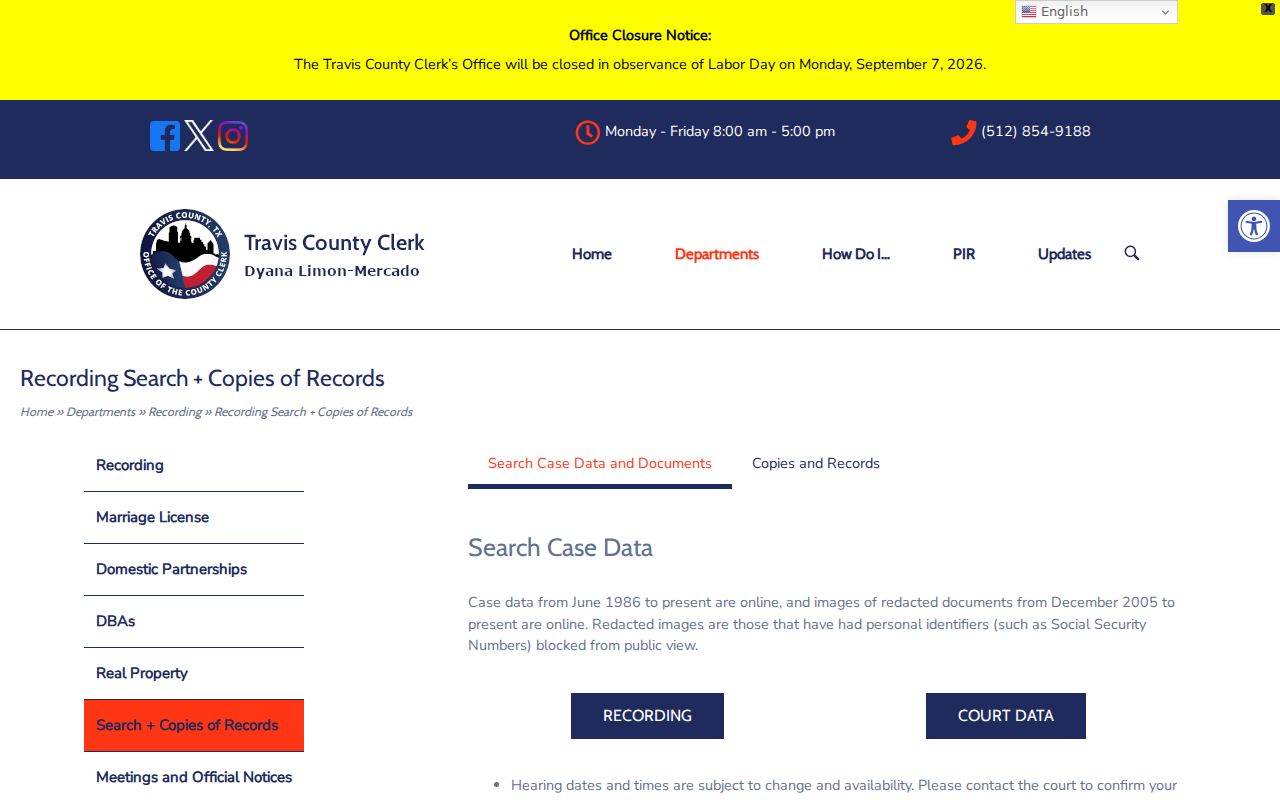
For Austin records, online prints are unofficial and watermarked. The Travis County Clerk documents Austin copy routes that include clerk-made and certified copies, self-service copies, microfilm or computer copies, and phone, email, mail, or in-person contact as appropriate to the record.
- Save the current Austin TCAD account, parcel, lot or block, subdivision, legal description, and address wording.
- Find the current purchase deed and record its instrument number, recorded date, document type, grantee, grantor, legal description, and referenced instruments.
- Search the seller from that deed as a grantee to locate the earlier purchase in the Austin chain. Search spelling, initials, married or maiden variants, and the legal subdivision when a name search is thin.
- Repeat backward by recorded date, verifying the lot, block, subdivision, or survey description at every transfer in the Austin chain.
- For Austin material before the online coverage, use the County Clerk library, County Archives, or Texas State Library microfilm. Travis deeds reach 1840, while TSL identifies deed-record microfilm for 1840-1886 and deed-of-trust microfilm for 1876-1894.
- Grantor and grantee
- The grantor conveys an interest in an instrument; the grantee receives that recorded interest. Either role is not proof of occupancy.
- Chain of title
- A sequence of recorded instruments connected through parties, dates, and the same legal parcel. It is not a title opinion.
- Legal description
- The lot, block, subdivision, survey, or related land wording that bridges a historic Austin document to a modern address.
- Criss-Cross directory
- An address-to-occupant directory used as a dated supporting source. Austin History Center lists this run from 1957 with gaps.
- Enumeration district
- A census geographic unit used to locate and read a particular enumeration, not a present-day neighborhood label.
Austin Directory Years and Census
Directories and census material can add household context to a deed trail, but both must be read at the date printed or enumerated. Austin city directories start in 1872-73 with gaps. The Austin History Center reports that its directories commonly have an address cross-reference after 1905, while older entries may require an alphabetical search. Its Criss-Cross holdings begin in 1957 with gaps. A first or last directory appearance can reflect collection timing, omission, or an edition gap, so it is not enough to establish a move or death.
- Choose a directory edition close to the recorded transfer or permit date and transcribe the address exactly as printed.
- Use the street or reverse section when it exists, then compare the alphabetical section for the same edition if a name needs confirmation.
- Pair that dated entry with the nearest available federal census schedule through AHC HeritageQuest or another federal source, keeping the census enumeration date visible.
- Check the parcel, legal description, and historic street wording before treating similar entries as the same address.
The historical Austin volumes themselves are described with the Austin city directory collections. Austin History Center, the Texas State Library, and the Briscoe Center have overlapping but nonidentical runs, so compare repositories rather than treating any one shelf as complete.
Note: A census is a dated household snapshot with undercount, boundary, and transcription limits, so record its date and source beside each directory entry.
Austin House Files and Sanborn Maps
The Austin History Center property guide adds an in-person path for a property chronology. House-Building Files are available only in the Reading Room and are not digitized. Staff can search the House-Building Database by address, building, or name. This is a useful next step when the recorded deed identifies land but does not explain when a structure first appears in the local file.
Sanborn maps add another dated layer. Austin runs identified by AHC and City materials are 1885, 1889, 1894, 1900, 1922, and 1935, with corrected updates through 1956, 1961, and 1971. The Library of Congress has a digitized July 1889 Austin item. These maps describe buildings, lots, uses, and fire-insurance context, not the people who lived there.
For early context, Travis County Archives also holds land registers from 1877-1936 and city lot registers from 1879-1974. Archive research is appointment-based, with books, microfilm, and digital holdings that may be indexed differently from the Clerk’s public portal.
Austin Permit and Aerial Dates
Austin Build + Connect can provide a public active-permit search for Austin property and project information. A permit or folder can tie an address to a project type, date, associated record material, notes, attachments, and related permits. It is an application or authorization record, not proof that a project was completed or that every listed person lived at the address.
Property Profile also offers historic aerial layers from 1940 through 2023. Aerial imagery can help bracket a building change alongside a permit and legal parcel, but it cannot identify previous residents. When an older permit file is not public in AB+C, use the City development-services records route or request existing records through the City’s public-information process.
Austin Address Changes Over Time
Austin’s record trail can cross city, county, postal, ZIP, and historic-jurisdiction boundaries. Annexation, disannexation, street renaming, address reassignment, redevelopment, and new planning overlays can make a continuous legal tract appear under different labels. Use the City’s annexation and address-range records for effective dates, ordinance context, and address ranges. Keep that local geography separate from a postal label.
The historic-preservation research guidance specifically warns of address renumbering and recommends working backward from the address. If the present number disappears from an earlier year, search the old street wording, lot or block, subdivision, and legal description before ending the search. Historic neighborhood labels also change in meaning, so retain the source wording rather than treating it as a timeless boundary.
Note: Store the original address text alongside a modern GIS crosswalk, because a ZIP, city limit, and recorded parcel may each describe a different layer.
Austin Previous Residents and Limits
Previous residents research can end with a carefully labeled local-history lead. Austin History Center’s cemetery database is based mainly on Oakwood ledger material from 1866-1921 and can provide burial and date context. The County Clerk probate route can provide estate and heirship material subject to access rules, with automated records described after July 1992 and earlier microfilm. Newspaper and obituary material can also help corroborate an endpoint, but it is not a substitute for a certified vital or court record.
A person’s name in an appraisal record, deed, directory, map, permit, cemetery ledger, or probate file has a source-specific meaning. A deed role may belong to a trust, corporation, estate, attorney-in-fact, or heir. A directory entry may reflect collection before publication. Preserve the source date, page or instrument number, and uncertainty rather than linking similar names without a shared address or date.
Lawful use. Austin previous-residents research is for personal house history, family history, and civic research. Texas Penal Code Chapter 42 includes harassment and stalking provisions, so do not use a historical trail to target, monitor, intimidate, or harm anyone.